


AERIAL MAPPING
Get accurate land surveys and GIS integration for your construction and development projects
Home / Aerial Mapping & Surveying
New Perspectives | Smarter Solutions
ADVANCED MAPPING CAPABILITIES
Professional deliverables ready for immediate use in your workflow
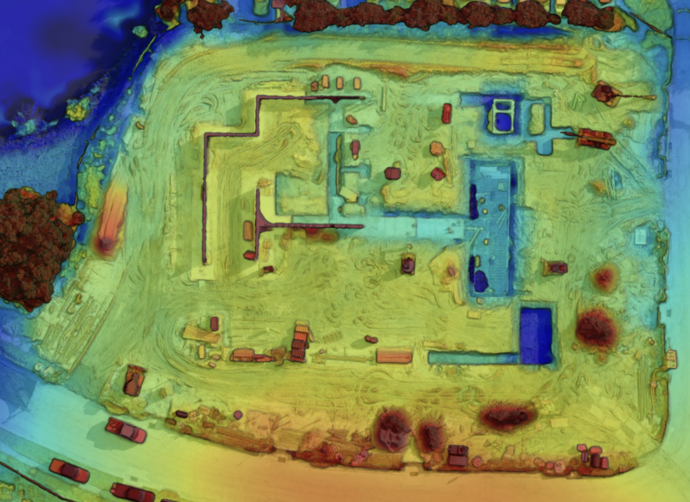
High-resolution orthomosaic maps
Digital elevation models (DEM)
3D point cloud data
CAD-ready survey files
Volumetric calculation reports
GPS coordinate datasets
Professional-grade surveying technology delivering precision results for critical decision-making
Precise
RTK GPS technology delivers survey-grade accuracy for professional applications
GIS Integration
Seamless integration with CAD systems and geographic information platforms
3D Terrain Modeling
Detailed elevation models and contour mapping for comprehensive site analysis
Digital Deliverables
CAD files, orthomosaic maps, and detailed reports in your preferred format

BENEFICIAL FOR
Our aerial mapping services are ideal for projects requiring precise geographic data and comprehensive site analysis.
🗸 Land development planning and feasibility studies
🗸 Construction site preparation and grading verification
🗸 Volumetric calculations for earthwork and materials
🗸 Infrastructure planning and utility corridor mapping
🗸 Environmental impact assessments and compliance
🗸 Property boundary verification and planning
READY FOR PRECISION MAPPING?
Get accurate, professional aerial surveys that accelerate your project timeline